Primary tabs

At the University of Michigan School for Environment and Sustainability (SEAS), we are at the forefront of building a more sustainable and just world for all by transforming the impact of higher education and reimagining the future. We are advancing action through innovation, research, education and engagement in society, and developing leaders who are empowered to halt the climate crisis and create an environmentally sound future for generations to come.

Data Extent

Other Access

The information on this page (the dataset metadata) is also available in these formats.

JSON RDF

via the DKAN API

Assessing and Communicating Climate and Water Ecosystem Services of the City of Ann Arbor Greenbelt Program

Abstract: 
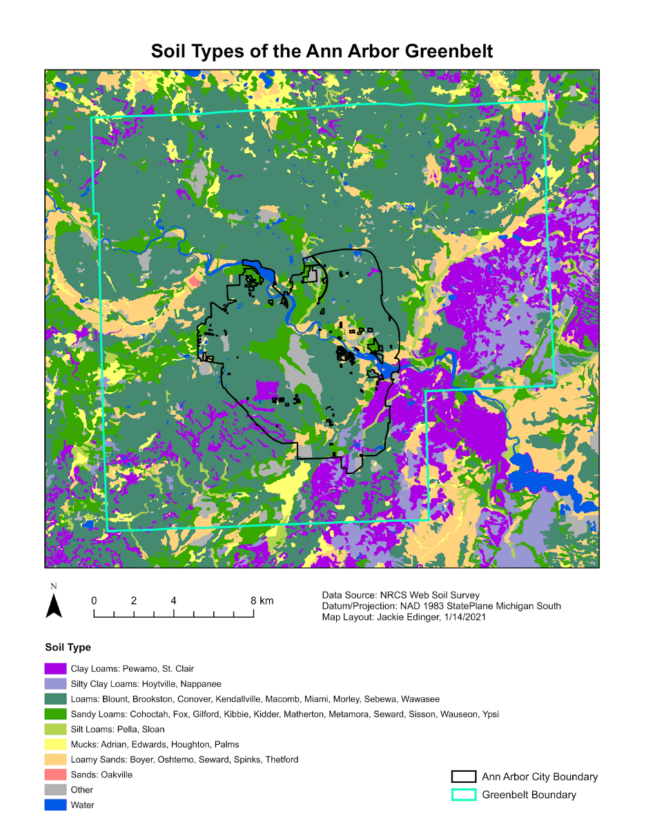
The Open Space and Parkland Preservation Millage was approved by the residents of Ann Arbor in November 2003 as a way to protect productive farmland, prevent the destruction of natural landscapes, and preserve the rural character surrounding Ann Arbor. Commonly known as the Greenbelt Program, the millage provides funds to preserve and protect open space, farmland, natural habitats, and the City’s source waters inside and outside the city limits. More than halfway through the 30-year millage in 2021, the Greenbelt Program consists of over 6,200 acres of protected land on more than 70 parcels. While successful, the program lacks adequate ways to report impact and motivate support beyond acres preserved and funds leveraged. Like many organizations working to protect land, they are in need of additional ways to assess and communicate more meaningful measures of conservation value, such as quantifying ecosystem services. Our goal was to develop a series of dynamic geoprocessing tools to quantify specific ecosystem service value of the Greenbelt’s current portfolio of properties and any new properties added in the future. This will allow the City staff and residents of Ann Arbor to have an ongoing understanding of and ability to communicate the value of individual properties and entire land conservation programs. We focused on two categories of ecosystem services: (1) above and belowground carbon storage and (2) water quality.
Methods: 
Aboveground Carbon Storage: We used a combination of field-collected and available remote sensing data to develop a model for measuring the amount of carbon stored in trees within forested areas of the Greenbelt. We acquired LiDAR (light detection and ranging) data of Washtenaw County from 2017 to estimate tree height and volume, and we measured tree species and diameter at three sites located in Washtenaw County to estimate tree biomass using allometric equations from the literature. Using these data sources, we compared the effectiveness of various modeling methods to predict biomass across sites. We found that a Power Law model allowed us to best estimate aboveground carbon storage. We were able to estimate both per-parcel and total aboveground carbon stored in the Ann Arbor Greenbelt, which as of April 2021 totals 32,595,817 kg C, or 119,519 metric tons of CO2. This is equivalent to the annual CO2 emissions of 2,716 average Ann Arbor households, 80,682,715 passenger vehicle miles, or 1,348,245 airline miles. This equates to a value of $6,095,473.15 when using the 2021 EPA social cost of carbon value of $51 per metric ton of CO2.
Belowground Carbon Storage: To estimate the amount of carbon stored in the soil of Greenbelt properties we used available spatial data on soil type together with standards from the literature for calculating carbon stored in the organic matter of soils. We used the National Resources Conservation Service (NRCS) Web Soil Survey to determine which soil types are present in the forested and wetland areas of the Greenbelt District and which characteristics, including horizon depth, bulk density, and organic matter content, are known to be associated with these soil types. Transferring these values into ArcGIS Pro allowed us to provide low, medium, and high estimates of carbon storage for each soil type and develop a model to calculate soil carbon stored at an individual property level. We found that the estimated carbon contained in the uppermost horizon of forested and wetland soils of the Greenbelt properties as of April 2021 totals 50,005,732 kg C, or 183,356 metric tons of CO2. This is equivalent to the annual CO2 emissions of 4,167 average Ann Arbor households, 123,776,564 passenger vehicle miles, or 2,068,363 airline miles. Using the EPA’s 2021 social cost of carbon value, we found that the Greenbelt properties have a value of $9,351,156.96. Agricultural soils were not included in estimates given that soil carbon would depend highly on specific cultivation practices, which are neither constant nor easy to assess.
Water Quality: To evaluate how land protection under the Greenbelt program contributes to water ecosystem services, we compared tools that assess the impact of land conversion on water quality. Based on this review we recommended amendments to existing tools that would improve their applicability to the Greenbelt Program and accessibility for other land conservancies in Southeast Michigan. Specifically, we provided an updated web-based version of the EPA Region 5 Conservation Easement Load Reduction Worksheet and identified the Michigan State University Institute of Water Research’s Great Lakes Watershed Management System (GLWMS) as the optimal tool for future water quality analyses within Washtenaw County. We recommend further collaboration with the Institute of Water Research to expand the spatial scope of its tool to include the Huron River Watershed.
FieldValue
Publisher
Modified
2021-07-27
Release Date
2021-06-24
Spatial / Geographical Coverage Area
POLYGON ((-443.84321086574 42.196699038498, -443.84321086574 42.338290982263, -443.58400365338 42.338290982263, -443.58400365338 42.196699038498))
Temporal Coverage
Sunday, September 27, 2020 - 00:00 to Sunday, October 25, 2020 - 00:00
Author
Jackie Edinger, Jessica Einck, Sebastian Kasparian, Lavran Pagano
Contact Name
Yifan Luo
Contact Email
Public Access Level
Public
Publication Date: 
Thursday, June 24, 2021