
![[Open Data]](https://assets.okfn.org/images/ok_buttons/od_80x15_blue.png)
Data and Resources
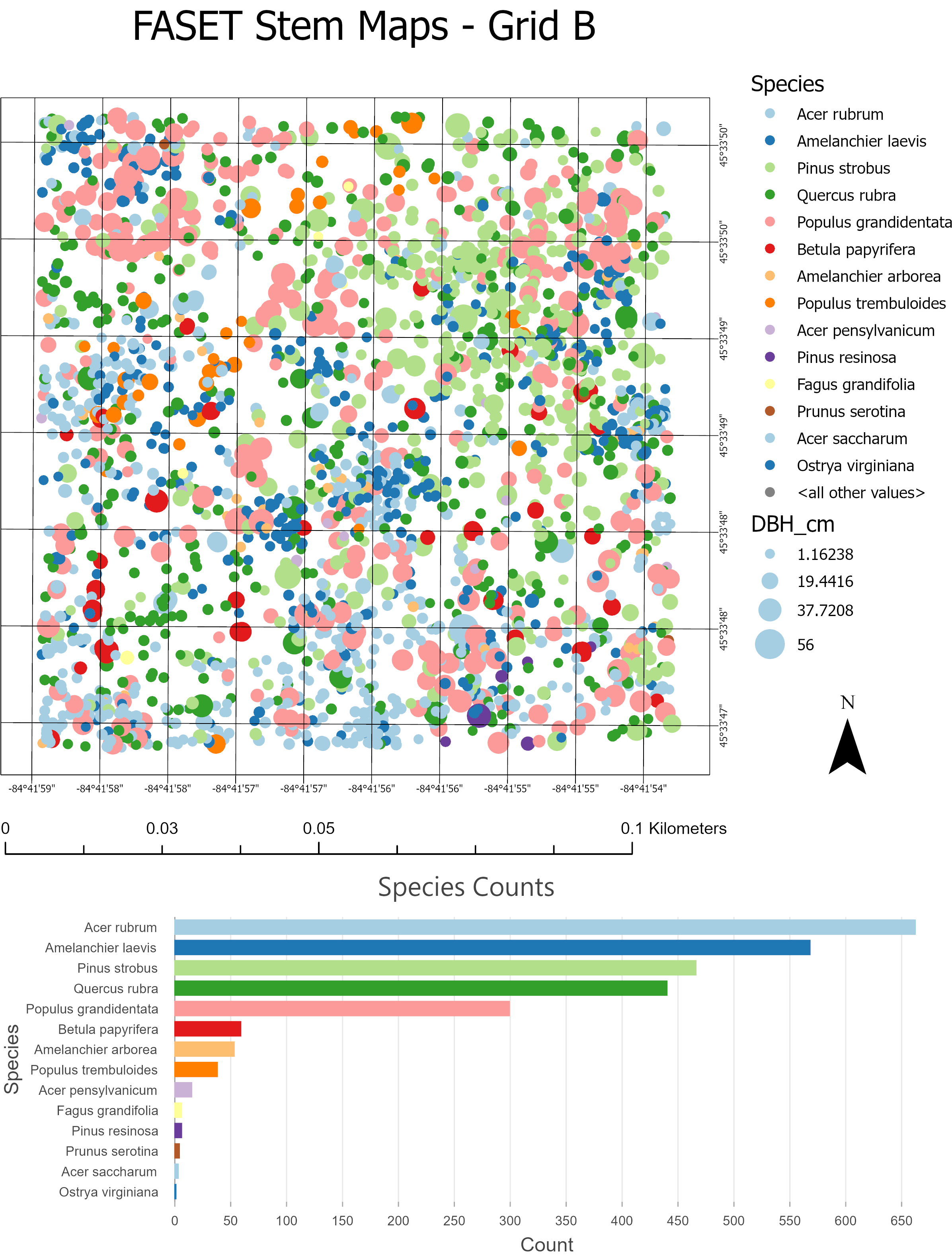
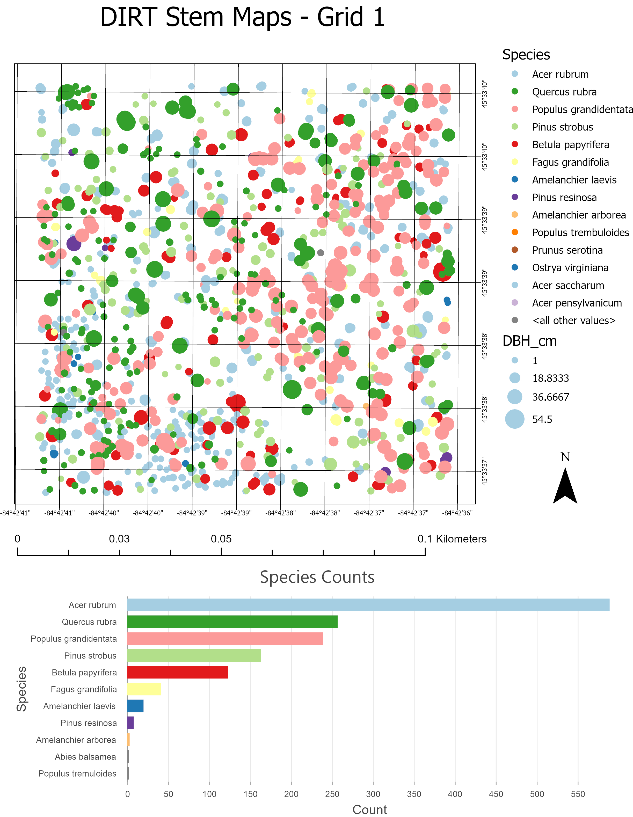
- FASET and DIRT Stem Mapsarcgis
Species locations ploted by individual trees including size (DBH) and...
Download

| Field | Value |
|---|---|
| Publisher | |
| Modified | 2021-09-01 |
| Release Date | 2021-08-12 |
| Spatial / Geographical Coverage Area | POLYGON ((-84.71248626709 45.531988684097, -84.71248626709 45.568052316123, -84.632835388184 45.568052316123, -84.632835388184 45.531988684097)) |
| Spatial / Geographical Coverage Location | University of Michigan Biological Station |
| Temporal Coverage | Thursday, June 1, 2006 - 00:00 to Friday, August 31, 2007 - 00:00 |
| Granularity | tree |
| Author | |
| Contact Name | William Currie |
| Contact Email | |
| Public Access Level | Public |
Publication Date:
Thursday, August 12, 2021