
![[Open Data]](https://assets.okfn.org/images/ok_buttons/od_80x15_blue.png)
Abstract:
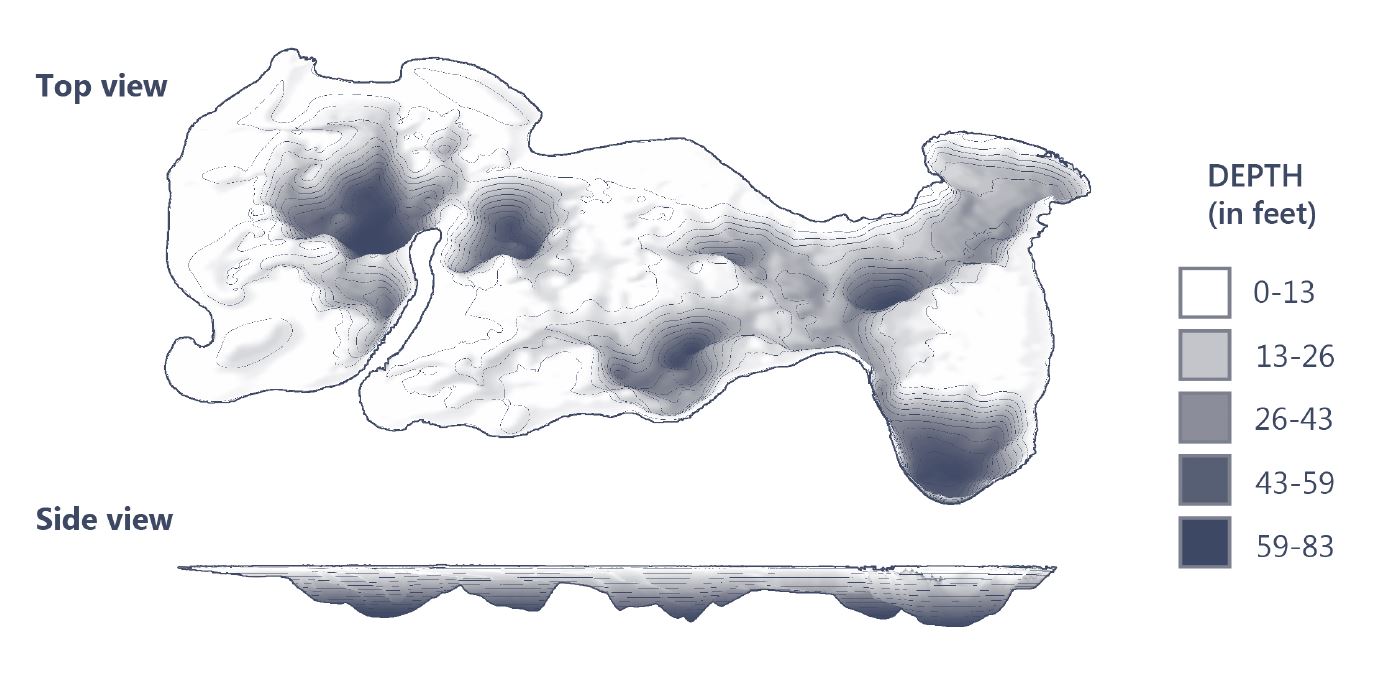
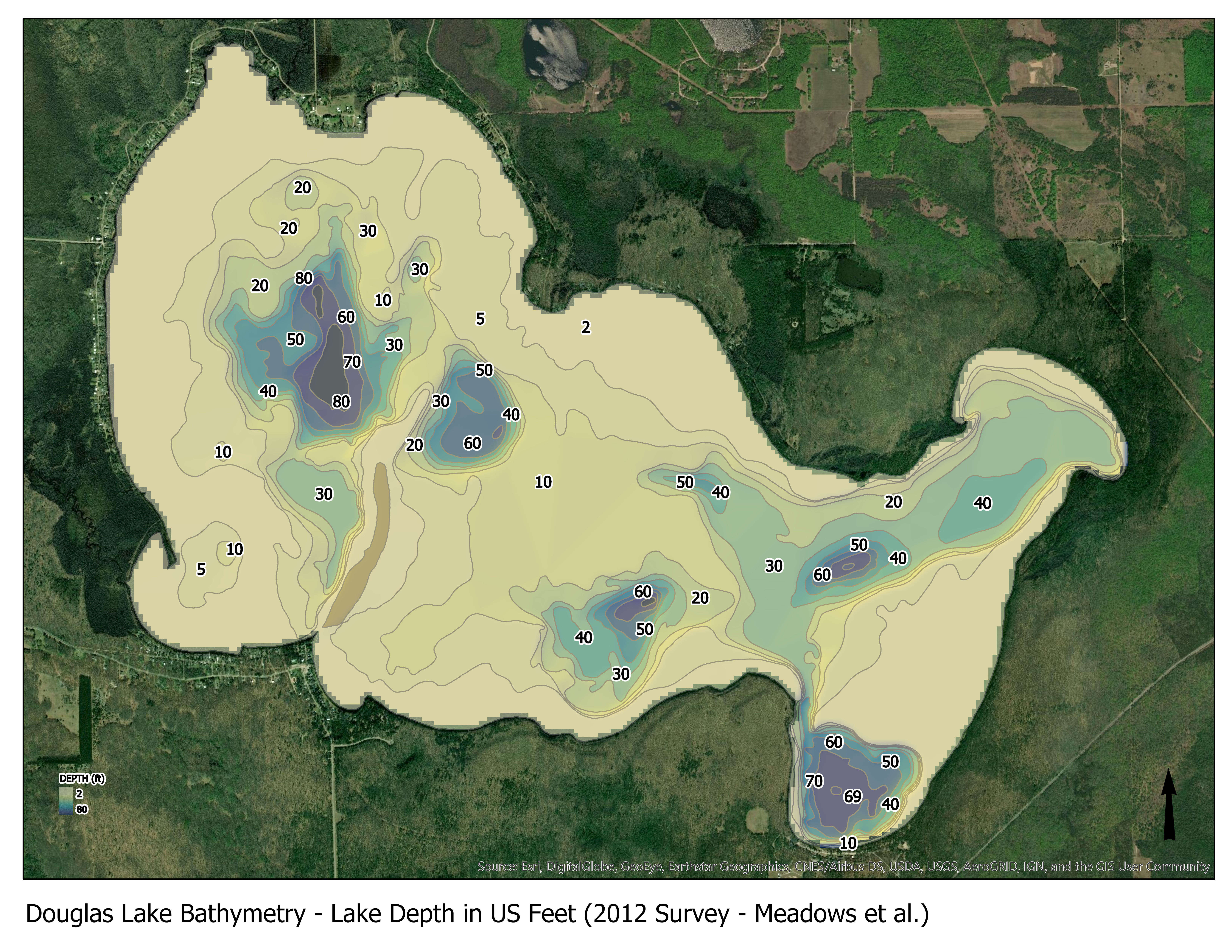
Douglas Lake bathymetric contours
Data and Resources
| Field | Value |
|---|---|
| Publisher | |
| Modified | 2023-05-24 |
| Release Date | 2019-04-03 |
| Spatial / Geographical Coverage Area | POLYGON ((-84.745273590088 45.554670149705, -84.745273590088 45.607053857867, -84.646396636963 45.607053857867, -84.646396636963 45.554670149705)) |
| Temporal Coverage | Monday, January 1, 1934 - 00:00 to Saturday, December 1, 2012 - 00:00 |
| Author | |
| Contact Name | UMBS data manager |
| Contact Email | |
| Public Access Level | Public |