
![[Open Data]](https://assets.okfn.org/images/ok_buttons/od_80x15_blue.png)
Abstract:
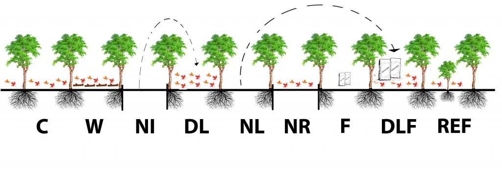
above ground measurements to assess system inputs
Data and Resources
| Field | Value |
|---|---|
| Publisher | |
| Modified | 2021-09-15 |
| Release Date | 2020-10-09 |
| Spatial / Geographical Coverage Area | POLYGON ((-84.711956972824 45.55593695267, -84.711956972824 45.558841697528, -84.707007403995 45.558841697528, -84.707007403995 45.55593695267)) |
| Author | |
| Contact Name | UMBS Data Manager |
| Contact Email | |
| Public Access Level | Public |
Publication Date:
Friday, October 9, 2020