![[Open Data]](https://assets.okfn.org/images/ok_buttons/od_80x15_blue.png)
Abstract:
The University of Michigan’s School for Environment and Sustainability (SEAS) currently owns 1,761 acres across six properties in Southeastern Michigan, including Saginaw Forest, Stinchfield Woods, Newcomb Tract, St. Pierre Wetland, Harper Preserve, and Ringwood Forest. These natural areas accompany various satellite properties owned or managed by other University departments, existing as part of a broad patchwork of preserved property across the state of Michigan. The diverse array of habitats across the sites and vast networks of local and regional stakeholders present a unique opportunity to reexamine the goals and management plans for these properties, and to further demonstrate the University’s commitment to land preservation, sustainable stewardship, and carbon neutrality. With these goals in mind, our team utilized several interdisciplinary research methods during the course of this project, largely consisting of carbon sequestration and storage analyses, remote sensing and GIS, and social research considerations. Over the past year, these approaches were used to arrive at holistic, concrete recommendations for both current and future property uses and considerations, which will lay the groundwork for forthcoming SEAS masters projects at each specific property. Our results point towards a wealth of new management and utilization objectives, including carbon neutrality and pricing, stewardship program initiatives, joint management models with land conservancies, and expanded opportunities for engagement with U-M faculty and students, local and regional institutions and organizations, and the general public.
Data and Resources
- Field Sample Plot Locations for each propertyzip
Field data for carbon storage within woody biomass were collected at each of...
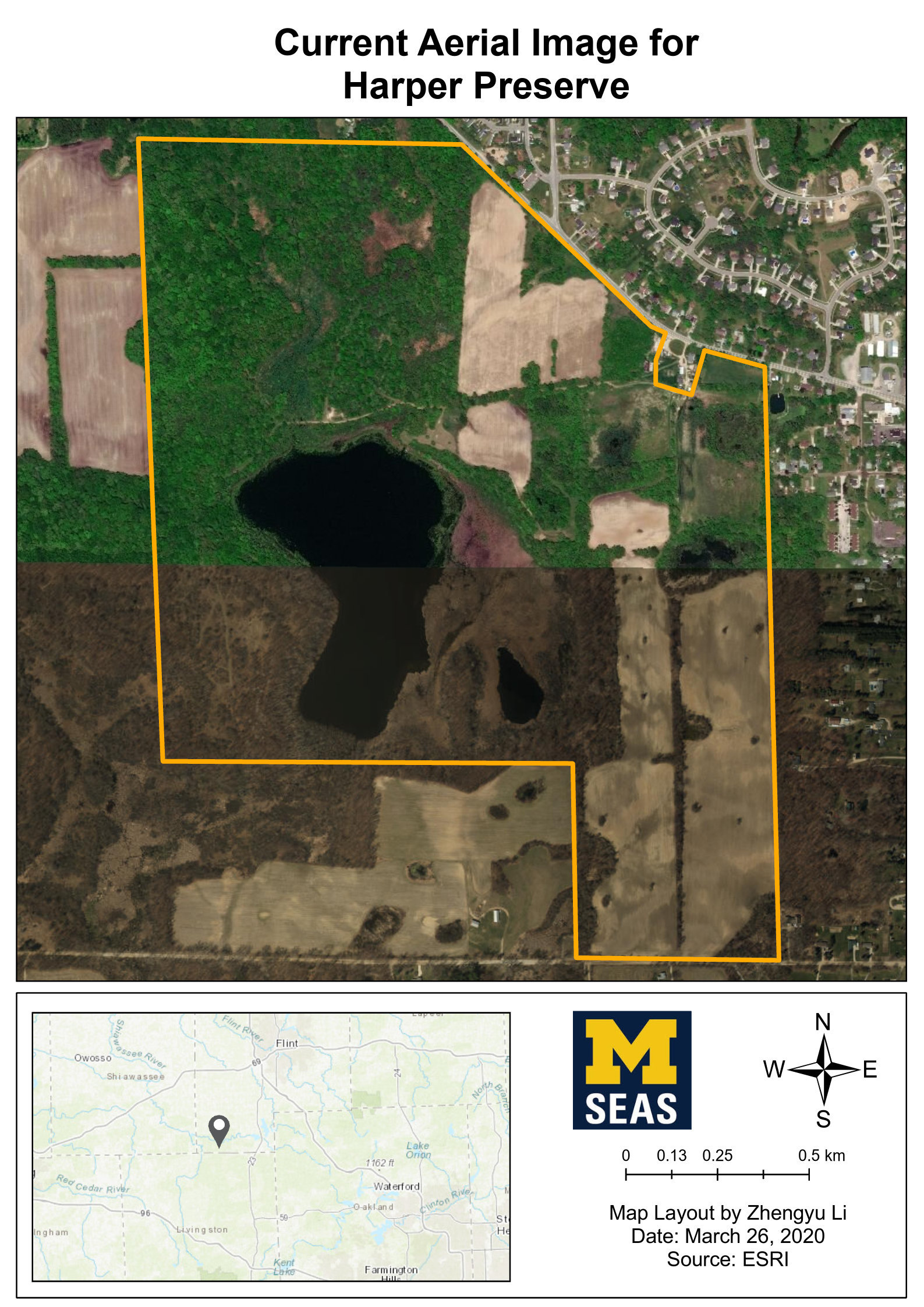
Download - Property boundary of Harper Preservezip
Boundary of the University of Michigan Harper Preserve property. The...
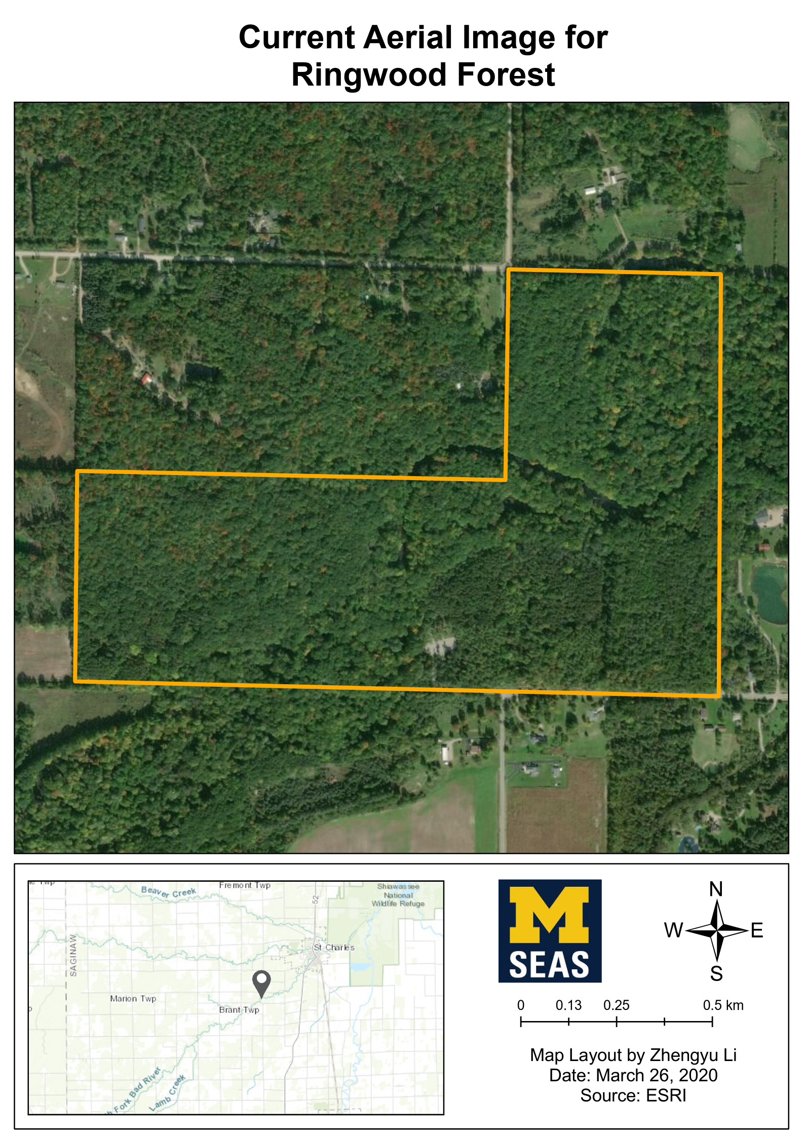
Download - Property boundary of Ringwood Forestzip
Boundary of the University of Michigan Ringwood Forest property. The...
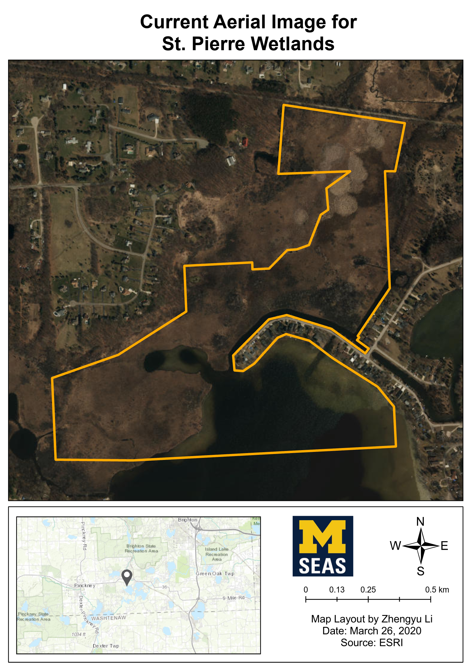
Download - Property boundary of St. Pierre Wetlandzip
Boundary of the University of Michigan St. Pierre Wetland property. The...
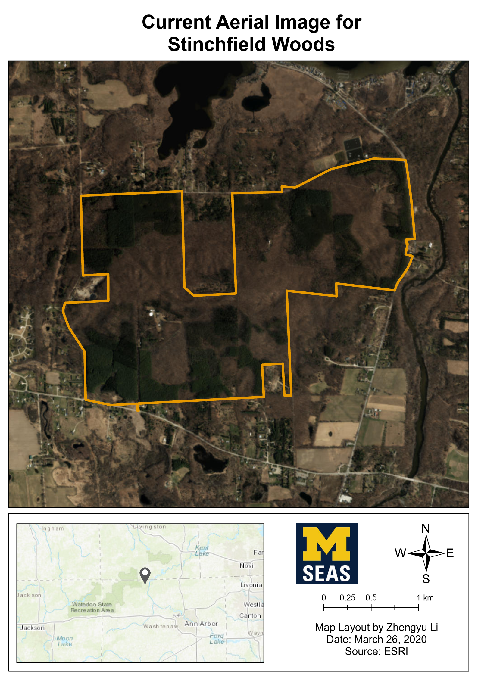
Download - Current Aerial Images for each propertyzip
High resolution aerial imageries were from Nearmap, include property...
Download - Current LULC (Land Use/Land Change) Raster data for each propertyzip
Supervised LULC Classifications
Download
To analyze the current land use and... - Current LULC (Land Use/Land Change) Map Layouts for each propertyzip
Supervised LULC Classifications
Download
To analyze the current land use and... - Drone Orthomosaic Image of Harper Preservezip
An orthomosaic of the Southwest portion of Harper Preserve including Murray...
Download


| Field | Value |
|---|---|
| Publisher | |
| Modified | 2021-07-27 |
| Release Date | 2021-06-23 |
| Rights | This dataset is still required for editing. |
| Spatial / Geographical Coverage Area | POLYGON ((-84.260035827756 42.186386656408, -84.260035827756 42.863874976379, -83.268089219928 42.863874976379, -83.268089219928 42.186386656408)) |
| Temporal Coverage | Friday, November 1, 2019 - 00:00 to Saturday, February 29, 2020 - 00:00 |
| Author | |
| Contact Name | Yifan Luo |
| Contact Email | |
| Public Access Level | Public |